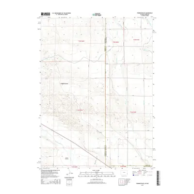
2015 Map of Torrington SE
USGS Topo · Published 2015About this map
The North Platte River winds through the southern portion of this landscape, marking a vital water corridor along the Goshen Co Sioux Co border. This region, captured in 2015, is defined by an extensive network of irrigation infrastructure essential to High Plains agriculture. The Interstate Canal cuts across the northern terrain, supplemented by numerous managed waterways including Lateral Number 4, Lateral Number 3, and the Lateral 7 Main. These systems support the rural reaches surrounding Torrington and the low-lying Hunton Meadows. The map reveals a highly structured grid of section lines and county roads, such as Road 140 and Road 64, which frame the agricultural tracts of the Platte Valley. Intersecting the state line between Wyoming and Nebraska, the survey documents the precise intersection of water management and political boundaries in the American West.
Find a feature on this map
39 named features on this map. Tap any name to fly to it.
Don’t see what you’re looking for? This feature index may not catch every label — zoom into the map to look around manually.
Map Details
Editions of this 2015 Torrington SE Map
This is the sole edition of this map. No revisions or reprints were ever made.
Other maps of this area

1896 · Patrick
USGS Topo · 1:125,000

1898 · Scotts Bluff
USGS Topo · 1:125,000

1899 · Goshen Hole
USGS Topo · 1:125,000

1899 · Whistle Creek
USGS Topo · 1:125,000

1954 · Scottsbluff
USGS Topo · 1:250,000

1954 · Torrington
USGS Topo · 1:250,000

1954 · Cheyenne
USGS Topo · 1:250,000

1955 · Alliance
USGS Topo · 1:250,000

1957 · Alliance
USGS Topo · 1:250,000

1958 · Cheyenne
USGS Topo · 1:250,000