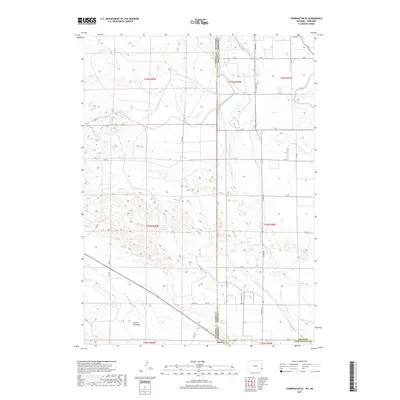
2017 Map of Torrington SE
USGS Topo · Published 2017About this map
The North Platte River flows through the southwestern corner of this borderland landscape, where the high plains of Wyoming meet the Nebraska panhandle. The settlement of Henry sits directly on the state line, serving as a focal point for a region defined by its sophisticated water management systems. A dense network of irrigation infrastructure, including the Interstate Canal and various channels like Lateral Number 3, Lateral Number 4, and Lateral 7 Main, illustrates the intensive agricultural development required to transform this arid terrain. North of the river, Hunton Meadows provides a distinct geographical marker amidst the section lines and rural road grids. The map also traces the winding course of Sheep Cr as it moves through the eastern portion of the quadrangle, highlighting the relationship between natural drainage and the engineered waterways that support the local ranching and farming economy.
Find a feature on this map
40 named features on this map. Tap any name to fly to it.
Don’t see what you’re looking for? This feature index may not catch every label — zoom into the map to look around manually.
Map Details
Editions of this 2017 Torrington SE Map
This is the sole edition of this map. No revisions or reprints were ever made.
Other maps of this area

1896 · Patrick
USGS Topo · 1:125,000

1898 · Scotts Bluff
USGS Topo · 1:125,000

1899 · Goshen Hole
USGS Topo · 1:125,000

1899 · Whistle Creek
USGS Topo · 1:125,000

1954 · Scottsbluff
USGS Topo · 1:250,000

1954 · Torrington
USGS Topo · 1:250,000

1954 · Cheyenne
USGS Topo · 1:250,000

1955 · Alliance
USGS Topo · 1:250,000

1957 · Alliance
USGS Topo · 1:250,000

1958 · Cheyenne
USGS Topo · 1:250,000