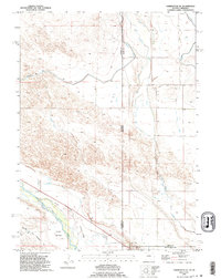
1990 Map of Torrington SE
USGS Topo · Published 1995About this map
The North Platte River carves through the southwestern corner of this quadrangle, defining a landscape shaped by both overland migration and industrial-scale irrigation. The Emigrant Trail (Approximate Location) parallels the river, marking the historic path through Hunton Meadows. This convergence of trails and water is further commemorated by a Historical Monument near the state line, where the border between Wyoming and Nebraska divides the area.
Find a feature on this map
20 named features on this map. Tap any name to fly to it.
Don’t see what you’re looking for? This feature index may not catch every label — zoom into the map to look around manually.
Map Details
Editions of this 1990 Torrington SE Map
This is the sole edition of this map. No revisions or reprints were ever made.
Other maps of this area

1896 · Patrick
USGS Topo · 1:125,000

1898 · Scotts Bluff
USGS Topo · 1:125,000

1899 · Goshen Hole
USGS Topo · 1:125,000

1899 · Whistle Creek
USGS Topo · 1:125,000

1954 · Scottsbluff
USGS Topo · 1:250,000

1954 · Torrington
USGS Topo · 1:250,000

1954 · Cheyenne
USGS Topo · 1:250,000

1955 · Alliance
USGS Topo · 1:250,000

1957 · Alliance
USGS Topo · 1:250,000

1958 · Cheyenne
USGS Topo · 1:250,000