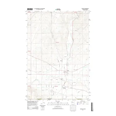
2014 Map of Touchet
USGS Topo · Published 2014About this map
The confluence of the Touchet River and the Walla Walla River anchors this study of the agricultural heart of the Walla Walla Valley. This 2014 survey documents the sophisticated water management systems essential to the region, including the Gardena Ditch, the Touchet W Side Ditch, and the S Ditch near the Washington Oregon state line. The settlement of Touchet sits centrally at a major river junction, while Gardena lies to the south, surrounded by a grid of rural roads like Gardena Rd and Riggs Rd that service the surrounding orchards and fields.
Find a feature on this map
63 named features on this map. Tap any name to fly to it.
Don’t see what you’re looking for? This feature index may not catch every label — zoom into the map to look around manually.
Map Details
Editions of this 2014 Touchet Map
This is the sole edition of this map. No revisions or reprints were ever made.
Other maps of this area

1915 · Wallulah
USGS Topo · 1:96,000

1918 · Wallula
USGS Topo · 1:125,000

1935 · Pendleton
USGS Topo · 1:125,000

1953 · Pendleton
USGS Topo · 1:250,000

1953 · Walla Walla
USGS Topo · 1:250,000

1956 · Pendleton
USGS Topo · 1:250,000

1958 · Walla Walla
USGS Topo · 1:250,000

1964 · Zangar Junction
USGS Topo · 1:24,000

1964 · Slater
USGS Topo · 1:24,000
1966 · Smeltz
USGS Topo · 1:24,000