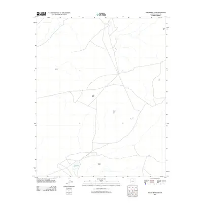
2011 Map of Tovar Mesa East
USGS Topo · Published 2011About this map
Tovar Mesa dominates this landscape in Arizona's Navajo County, characterized by a complex network of unpaved tracks and localized terrain features. The presence of Indian Rte 6620 in the southern sector serves as a primary transit corridor through this arid expanse. This 2011 survey documents a sparsely populated region where named landmarks often refer to distinct geological overlooks and high points. Along the eastern and northern reaches, small rises like Seed Hill and Leaf Hill provide vertical relief. The southwestern portion is notable for the isolated water source of Tobenayoli Pond, situated near the base of Pillow Ridge. These features indicate a terrain where water and high-ground visibility were critical for navigation and land use by the local community.
Find a feature on this map
9 named features on this map. Tap any name to fly to it.
Don’t see what you’re looking for? This feature index may not catch every label — zoom into the map to look around manually.
Map Details
Editions of this 2011 Tovar Mesa East Map
This is the sole edition of this map. No revisions or reprints were ever made.
Other maps of this area

1883 · Tusayan
USGS Topo · 1:250,000

1886 · Tusayan
USGS Topo · 1:250,000

1947 · Flagstaff
USGS Topo · 1:250,000

1954 · Flagstaff
USGS Topo · 1:250,000

1958 · Flagstaff
USGS Topo · 1:250,000

1960 · Flagstaff
USGS Topo · 1:250,000

1962 · Flagstaff
USGS Topo · 1:250,000

1966 · Egloffstein Butte
USGS Topo · 1:62,500

1966 · Tovar Mesa
USGS Topo · 1:62,500
1967 · Shonto Butte
USGS Topo · 1:24,000