
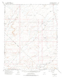
1966 Map of Tovar Mesa
USGS Topo · Published 1968About this map
The high plateau of the Hopi Indian Reservation and the surrounding Navajo Hopi Joint Use Area define this mid-1960s landscape in Navajo and Coconino Counties. This arid expanse is characterized by deep drainages like Oraibi Wash and Polacca Wash, which cut through the wind-swept Sand Dunes and the rising slopes of Tovar Mesa. Water management is the central theme of human activity shown here, evident in the network of small reservoirs such as Navajo Lookout Dam, Backbone Dam, and White Clay Dam.
Find a feature on this map
36 named features on this map. Tap any name to fly to it.
Don’t see what you’re looking for? This feature index may not catch every label — zoom into the map to look around manually.
Map Details
Editions of this 1966 Tovar Mesa Map
2 editions found
Other maps of this area

1883 · Tusayan
USGS Topo · 1:250,000

1886 · Tusayan
USGS Topo · 1:250,000

1947 · Flagstaff
USGS Topo · 1:250,000

1954 · Flagstaff
USGS Topo · 1:250,000

1955 · Leupp
USGS Topo · 1:62,500

1958 · Flagstaff
USGS Topo · 1:250,000

1960 · Flagstaff
USGS Topo · 1:250,000

1962 · Flagstaff
USGS Topo · 1:250,000

1966 · Oraibi
USGS Topo · 1:62,500

1966 · Egloffstein Butte
USGS Topo · 1:62,500