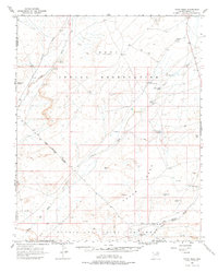
1966 Map of Tovar Mesa
USGS Topo · Published 1976About this map
Tovar Mesa dominates this landscape of the Hopi Indian Reservation, where the high desert floor is carved by the ephemeral flows of Oraibi Wash and Polacca Wash. This mid-1960s mapping record highlights a transition in land management within the Navajo-Hopi Joint Use Area, featuring the small settlements of Shalako and Tees Toh. The geography is defined by a series of named points and ridges, including the prominent Giants Chair, Crows Nest Point, and Lost Gun Point. The importance of water in this arid environment is evident through the documentation of scattered springs like Little Burro Spring and Coyote Spring, as well as several earthen barriers such as Backbone Dam and Navajo Lookout Dam. A single Quarry and a network of jeep trails provide clues to the local economy and movement across the sweeping sand dunes that characterize the southern reaches of the quadrangle.
Find a feature on this map
34 named features on this map. Tap any name to fly to it.
Don’t see what you’re looking for? This feature index may not catch every label — zoom into the map to look around manually.
Map Details
Editions of this 1966 Tovar Mesa Map
2 editions found

Other maps of this area

1883 · Tusayan
USGS Topo · 1:250,000

1886 · Tusayan
USGS Topo · 1:250,000

1947 · Flagstaff
USGS Topo · 1:250,000

1954 · Flagstaff
USGS Topo · 1:250,000

1955 · Leupp
USGS Topo · 1:62,500

1958 · Flagstaff
USGS Topo · 1:250,000

1960 · Flagstaff
USGS Topo · 1:250,000

1962 · Flagstaff
USGS Topo · 1:250,000

1966 · Oraibi
USGS Topo · 1:62,500

1966 · Egloffstein Butte
USGS Topo · 1:62,500