
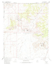
1966 Map of Oraibi
USGS Topo · Published 1968About this map
Third Mesa and Second Mesa dominate this mid-century survey of the Hopi Indian Reservation, where ancient settlement patterns remain clearly visible. High atop the plateaus, the map documents the arrangement of established villages including Hotevilla, Bacabi, and Old Oraibi, the latter featuring a Tug-of-War Historical Marker. The cultural depth of the landscape is further revealed through several identified archaeological locations such as Ma Shon Pi and Huck Ovi.
Find a feature on this map
53 named features on this map. Tap any name to fly to it.
Don’t see what you’re looking for? This feature index may not catch every label — zoom into the map to look around manually.
Map Details
Editions of this 1966 Oraibi Map
2 editions found
Other maps of this area

1883 · Marsh Pass
USGS Topo · 1:250,000

1883 · Tusayan
USGS Topo · 1:250,000

1886 · Tusayan
USGS Topo · 1:250,000

1892 · Marsh Pass
USGS Topo · 1:250,000

1947 · Flagstaff
USGS Topo · 1:250,000

1954 · Flagstaff
USGS Topo · 1:250,000

1956 · Marble Canyon
USGS Topo · 1:250,000

1958 · Flagstaff
USGS Topo · 1:250,000

1959 · Marble Canyon
USGS Topo · 1:250,000

1960 · Flagstaff
USGS Topo · 1:250,000