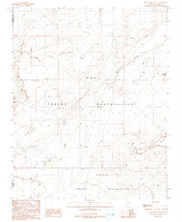
1991 Map of Tovar Mesa West
USGS Topo · Published 1991About this map
Hopi Indian Reservation and Navajo Indian Reservation lands converge across this arid high-desert landscape in the early 1990s. The terrain is defined by the prominent Tovar Mesa to the southeast and the steep overlook at Elbow Point in the northeast. Water management is the primary human footprint on this map, as evidenced by a network of scattered infrastructure. The seasonal Polacca Wash cuts through the territory, supported by a localized Levee to manage intermittent flow. Ranching and livestock survival are indicated by the presence of multiple Corral sites, Water Tanks, and a Well, marking the essential points of utility in a region where the boundary between Coconino and Navajo counties bisects the open range.
Find a feature on this map
10 named features on this map. Tap any name to fly to it.
Don’t see what you’re looking for? This feature index may not catch every label — zoom into the map to look around manually.
Map Details
Editions of this 1991 Tovar Mesa West Map
This is the sole edition of this map. No revisions or reprints were ever made.
Other maps of this area

1883 · Tusayan
USGS Topo · 1:250,000

1886 · Tusayan
USGS Topo · 1:250,000

1947 · Flagstaff
USGS Topo · 1:250,000

1954 · Flagstaff
USGS Topo · 1:250,000

1955 · Leupp
USGS Topo · 1:62,500

1958 · Flagstaff
USGS Topo · 1:250,000

1960 · Flagstaff
USGS Topo · 1:250,000

1962 · Flagstaff
USGS Topo · 1:250,000

1966 · Tovar Mesa
USGS Topo · 1:62,500
1967 · Garces Mesas SE
USGS Topo · 1:24,000