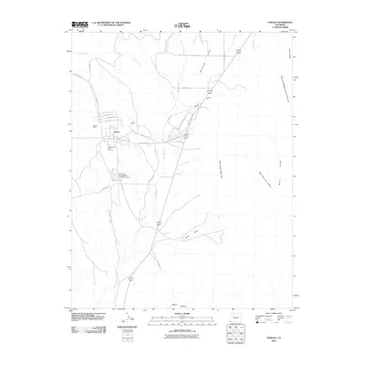
2010 Map of Towaoc
USGS Topo · Published 2010About this map
Towaoc serves as the focal point of this southwestern Colorado landscape, situated within the Montezuma Valley under the looming presence of the Mesa Verde West Rim. The layout of the settlement is defined by streets such as Chief Ignacio St and Lafayette St, while the community’s cultural infrastructure is anchored by the Ute Mountain Tribal Cemetery and the Ute Mountain Indian Racetrack and Rodeo Grounds. These features, alongside the Towaoc Mine, illustrate a landscape shaped by indigenous heritage and local resource extraction.
Find a feature on this map
43 named features on this map. Tap any name to fly to it.
Don’t see what you’re looking for? This feature index may not catch every label — zoom into the map to look around manually.
Map Details
Editions of this 2010 Towaoc Map
This is the sole edition of this map. No revisions or reprints were ever made.
Other maps of this area

1956 · Cortez
USGS Topo · 1:250,000

1957 · Moqui SE
USGS Topo · 1:24,000

1958 · Cortez SW
USGS Topo · 1:24,000

1958 · Sentinel Peak NE
USGS Topo · 1:24,000

1958 · Cortez
USGS Topo · 1:250,000

1959 · Cortez
USGS Topo · 1:250,000

1962 · Cortez
USGS Topo · 1:250,000

1965 · Cortez
USGS Topo · 1:24,000

1966 · Cortez
USGS Topo · 1:250,000
1966 · Moqui Canyon
USGS Topo · 1:24,000