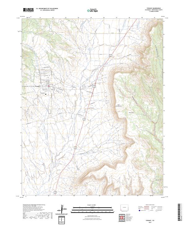
2023 Map of Towaoc
USGS Topo · Published 2023About this map
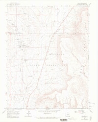
The community of Towaoc serves as the focal point of this modern survey, situated at the base of the prominent Mesa Verde West Rim. The landscape is defined by the transition from the high elevations of Mesa Verde and West Ute Mesa down into the complex drainage systems of Navajo Wash and Fisher Creek. Cultural landmarks such as the Ute Mountain Tribal Cem and the nearby Yucca House National Monument reflect the long-standing indigenous and archaeological significance of this Montezuma County region.
Find a feature on this map
52 named features on this map. Tap any name to fly to it.
Don’t see what you’re looking for? This feature index may not catch every label — zoom into the map to look around manually.
Map Details
Editions of this 2023 Towaoc Map
This is the sole edition of this map. No revisions or reprints were ever made.