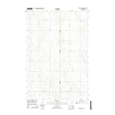
2014 Map of Tower City SW
USGS Topo · Published 2014About this map
Holy Trinity Cem sits as a solitary cultural landmark in this section of the Red River Valley, marking the rural landscape of eastern North Dakota. The area is defined by its precise section-line grid, where roads like 129th Ave SE and 42nd St SE carve the prairie into predictable agricultural plots. The eastern edge of the map features the meandering course of the Maple River, which provides the only significant break in the geometric regularity of the terrain. Straddling the boundary between Barnes Co and Cass Co, the geography reflects a late-century agricultural layout that remains largely unchanged in its primary structure, preserving the spatial arrangement of farmsteads and rural infrastructure as they functioned into the early 21st century.
Find a feature on this map
18 named features on this map. Tap any name to fly to it.
Don’t see what you’re looking for? This feature index may not catch every label — zoom into the map to look around manually.
Map Details
Editions of this 2014 Tower City SW Map
This is the sole edition of this map. No revisions or reprints were ever made.
Other maps of this area

1897 · Tower
USGS Topo · 1:125,000

1953 · Fargo
USGS Topo · 1:250,000

1956 · Fargo
USGS Topo · 1:250,000

1961 · Enderlin North
USGS Topo · 1:24,000

1965 · Alice
USGS Topo · 1:24,000

1965 · Lucca
USGS Topo · 1:24,000

1965 · Tower City SW
USGS Topo · 1:24,000

1967 · Tower City
USGS Topo · 1:24,000

1967 · Fingal
USGS Topo · 1:24,000
1967 · Buffalo
USGS Topo · 1:24,000