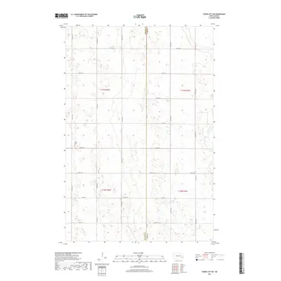
2017 Map of Tower City SW
USGS Topo · Published 2017About this map
The Maple River snakes through the eastern edge of this prairie landscape, defining the topography in an otherwise strictly gridded section of the North Dakota plains. Situated along the border of Barnes and Cass Counties, the area is characterized by the expansive township and range system, with section lines marked by a network of rural routes such as 129th Ave SE and 38th St SE. A primary point of local historical interest is the Holy Trinity Cem, located in the western portion of the map. This site serves as a vital anchor for genealogical research in a region where the human footprint is primarily defined by large-scale agricultural parcels and the occasional shelterbelt. The map reveals the meticulous organization of the land, from the primary corridor of Co Hwy 1 to the smaller county roads that service the surrounding farmsteads.
Find a feature on this map
23 named features on this map. Tap any name to fly to it.
Don’t see what you’re looking for? This feature index may not catch every label — zoom into the map to look around manually.
Map Details
Editions of this 2017 Tower City SW Map
This is the sole edition of this map. No revisions or reprints were ever made.
Other maps of this area

1897 · Tower
USGS Topo · 1:125,000

1953 · Fargo
USGS Topo · 1:250,000

1956 · Fargo
USGS Topo · 1:250,000

1961 · Enderlin North
USGS Topo · 1:24,000

1965 · Alice
USGS Topo · 1:24,000

1965 · Lucca
USGS Topo · 1:24,000

1965 · Tower City SW
USGS Topo · 1:24,000

1967 · Tower City
USGS Topo · 1:24,000

1967 · Fingal
USGS Topo · 1:24,000
1967 · Buffalo
USGS Topo · 1:24,000