
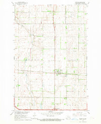
1965 Map of Tower City SW
USGS Topo · Published 1967About this map
Springvale and Hill townships dominate the northern reaches of this mid-1960s survey on the border of Barnes and Cass counties. The landscape is defined by the winding course of the Maple River, which cuts through the eastern edge of the quadrangle. A distinct rural infrastructure is visible, centered around the Holy Trinity Cem in the west and a local Gravel Pit further south, reflecting the small-scale agricultural and extractive economies of the era. The mapping, overseen by officials like Governor William L. Guy and Milo W. Hoisveen, captures a transition in the prairie landscape where township divisions like Binghamton and Clifton organized the sparse settlement patterns of the North Dakota plains.
Find a feature on this map
9 named features on this map. Tap any name to fly to it.
Don’t see what you’re looking for? This feature index may not catch every label — zoom into the map to look around manually.
Map Details
Editions of this 1965 Tower City SW Map
This is the sole edition of this map. No revisions or reprints were ever made.
Other maps of this area

1897 · Tower
USGS Topo · 1:125,000

1953 · Fargo
USGS Topo · 1:250,000

1956 · Fargo
USGS Topo · 1:250,000

1961 · Enderlin North
USGS Topo · 1:24,000

1965 · Alice
USGS Topo · 1:24,000

1965 · Lucca
USGS Topo · 1:24,000

1967 · Tower City
USGS Topo · 1:24,000

1967 · Fingal
USGS Topo · 1:24,000
1967 · Buffalo
USGS Topo · 1:24,000
1967 · Oriska
USGS Topo · 1:24,000