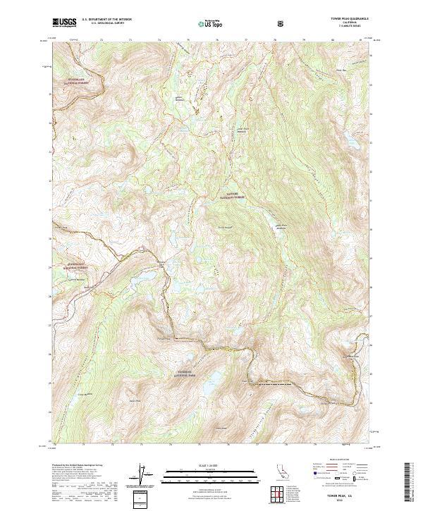
2022 Map of Tower Peak
USGS Topo · Published 2022About this map
Yosemite National Park, Toiyabe National Forest, and Stanislaus National Forest converge in this high-altitude landscape dominated by the Sierra Nevada. The map centers on the formidable Tower Peak and the high drainage basins of the W Walker River and Falls Cr. This terrain is defined by a dense network of high-country routes, most notably the Pacific Crest National Scenic Trl, which traverses several major passes including Dorothy Lake Pass and Bond Pass. The area is characterized by numerous glacial lakes and high meadows, such as Mary Lake, Dorothy Lake, and Summit Meadow, which provide critical reference points for backcountry travelers. The presence of the Mono and Tuolumne County line running along the Saurian Crest and through Tower Lake illustrates the political boundaries that bisect this wilderness, marking the divide between the eastern and western slopes.
Find a feature on this map
75 named features on this map. Tap any name to fly to it.
Don’t see what you’re looking for? This feature index may not catch every label — zoom into the map to look around manually.
Map Details
Editions of this 2022 Tower Peak Map
This is the sole edition of this map. No revisions or reprints were ever made.
Other maps of this area

1896 · Dardanelles
USGS Topo · 1:125,000

1898 · Dardanelles
USGS Topo · 1:125,000

1909 · Bridgeport
USGS Topo · 1:125,000

1911 · Bridgeport
USGS Topo · 1:125,000

1920 · Bridgeport
USGS Topo · 1:125,000

1948 · Walker Lake
USGS Topo · 1:250,000

1954 · Pickel Meadow
USGS Topo · 1:24,000

1954 · Fales Hot Springs
USGS Topo · 1:24,000

1956 · Sonora Pass
USGS Topo · 1:62,500

1956 · Fales Hot Springs
USGS Topo · 1:62,500