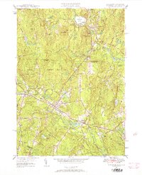
1950 Map of Townsend
USGS Topo · Published 1958About this map
Potanipo Pond and the surrounding marshlands of Talbot Swamp anchor the northern landscape of this mid-century survey, where the border between Massachusetts and New Hampshire divides the communities of Brookline and Townsend. The Boston and Maine Railroad follows the winding course of the Squannacook River, connecting the village centers of West Townsend, Townsend, and Townsend Harbor. This rail-and-river corridor supported a local economy evidenced by Cider Mill Pond and the extensive Townsend State Forest to the west.
Find a feature on this map
56 named features on this map. Tap any name to fly to it.
Don’t see what you’re looking for? This feature index may not catch every label — zoom into the map to look around manually.
Map Details
Editions of this 1950 Townsend Map
2 editions found
Other maps of this area

1887 · Fitchburg
USGS Topo · 1:62,500

1889 · Fitchburg
USGS Topo · 1:62,500

1893 · Fitchburg
USGS Topo · 1:62,500

1893 · Groton
USGS Topo · 1:62,500

1900 · Peterboro
USGS Topo · 1:62,500

1906 · Milford
USGS Topo · 1:62,500

1931 · Groton
USGS Topo · 1:48,000

1931 · Fitchburg
USGS Topo · 1:48,000

1935 · Ayer
USGS Topo · 1:24,000

1935 · Groton
USGS Topo · 1:62,500