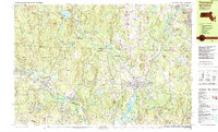
1988 Map of Townsend
USGS Topo · Published 1988About this map
The Nashua River and Nissitissit River corridors define the landscape of this border region in the late 1980s, where traditional New England villages like Pepperell and Townsend are surrounded by extensive conservation lands. The Boston and Maine RR traces a path through the valley, passing near industrial and civic markers such as the Sewage Disposal plant and Hollis Depot. Local education and community life are anchored by the North Middlesex Regional High Sch and several smaller institutions like the Hawthorne Brook Middle Sch.
Find a feature on this map
140 named features on this map. Tap any name to fly to it.
Don’t see what you’re looking for? This feature index may not catch every label — zoom into the map to look around manually.
Map Details
Editions of this 1988 Townsend Map
This is the sole edition of this map. No revisions or reprints were ever made.
Other maps of this area

1886 · Lowell
USGS Topo · 1:62,500

1887 · Fitchburg
USGS Topo · 1:62,500

1889 · Fitchburg
USGS Topo · 1:62,500

1893 · Lowell
USGS Topo · 1:62,500

1893 · Fitchburg
USGS Topo · 1:62,500

1893 · Groton
USGS Topo · 1:62,500

1900 · Peterboro
USGS Topo · 1:62,500

1905 · Manchester
USGS Topo · 1:62,500

1906 · Milford
USGS Topo · 1:62,500

1918 · Lowell
USGS Topo · 1:62,500