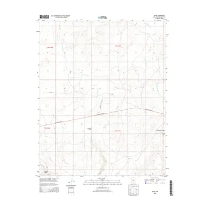
2013 Map of Toyee
USGS Topo · Published 2013About this map
Toyee and its surrounding canyonlands appear here in a region defined by high-desert drainage systems and remote transportation corridors. The landscape is carved by deep seasonal watercourses such as Soft Water Canyon and Burned Water Canyon, while the ephemeral flows of Soft Water Wash and Standing Rock Wash dictate the natural movement across the terrain. A critical water source, Toyee Spring, sits near the center of this quadrangle, a landmark of vital importance in this arid environment.
Find a feature on this map
16 named features on this map. Tap any name to fly to it.
Don’t see what you’re looking for? This feature index may not catch every label — zoom into the map to look around manually.
Map Details
Editions of this 2013 Toyee Map
This is the sole edition of this map. No revisions or reprints were ever made.
Other maps of this area

1886 · Wingate
USGS Topo · 1:250,000

1892 · Wingate
USGS Topo · 1:250,000

1954 · Gallup
USGS Topo · 1:250,000

1958 · Gallup
USGS Topo · 1:250,000

1959 · Gallup
USGS Topo · 1:250,000

1962 · Gallup
USGS Topo · 1:250,000
1963 · Dalton Pass
USGS Topo · 1:24,000
1963 · Hard Ground Flats
USGS Topo · 1:24,000
1963 · Oak Spring
USGS Topo · 1:24,000

1967 · Gallup
USGS Topo · 1:250,000