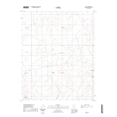
2020 Map of Toyee
USGS Topo · Published 2020About this map
Toyee and its surrounding landscape are defined by a network of drainage systems and historical transport routes across McKinley County. The settlement lies at a junction where Soft Water Wash flows from the southwest, eventually carving through Soft Water Canyon. These seasonal waterways are central to the terrain's character, with Standing Rock Wash to the east and the deeply incised Deadman Canyon to the south.
Find a feature on this map
17 named features on this map. Tap any name to fly to it.
Don’t see what you’re looking for? This feature index may not catch every label — zoom into the map to look around manually.
Map Details
Editions of this 2020 Toyee Map
This is the sole edition of this map. No revisions or reprints were ever made.
Other maps of this area

1886 · Wingate
USGS Topo · 1:250,000

1892 · Wingate
USGS Topo · 1:250,000

1954 · Gallup
USGS Topo · 1:250,000

1958 · Gallup
USGS Topo · 1:250,000

1959 · Gallup
USGS Topo · 1:250,000

1962 · Gallup
USGS Topo · 1:250,000
1963 · Dalton Pass
USGS Topo · 1:24,000
1963 · Hard Ground Flats
USGS Topo · 1:24,000
1963 · Oak Spring
USGS Topo · 1:24,000

1967 · Gallup
USGS Topo · 1:250,000