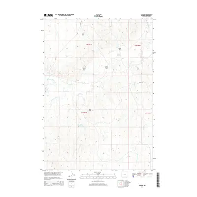
2015 Map of Trabing
USGS Topo · Published 2015About this map
The settlement of Trabing serves as a focal point in this high plains landscape of Johnson County, where the management of water is central to the area's development. A complex network of irrigation infrastructure is evident, including the Smith Ditch, Mitchell and Long Ditch, and Devon Ditch Number 1, which channel water across the terrain to sustain local ranching operations. The presence of several storage sites, such as the Trabing Reservoir, Zezas Reservoir, and Smith Reservoir Number 1, illustrates the vital necessity of water security in this arid environment. To the south, the Red Hills rise above the drainage basins of Crazy Woman Cr and Trabing Dry Cr. Significant land features like Lewis Draw, Colorado Flats Draw, and School Section Draw define the local topography, which is navigated by Trabing Rd and Irigaray Rd, connecting the scattered ranchlands and homesteads.
Find a feature on this map
27 named features on this map. Tap any name to fly to it.
Don’t see what you’re looking for? This feature index may not catch every label — zoom into the map to look around manually.
Map Details
Editions of this 2015 Trabing Map
This is the sole edition of this map. No revisions or reprints were ever made.
Other maps of this area

1900 · Fort McKinney
USGS Topo · 1:125,000

1903 · Fort McKinney
USGS Topo · 1:125,000

1955 · Sheridan
USGS Topo · 1:250,000

1955 · Arminto
USGS Topo · 1:250,000

1958 · Sheridan
USGS Topo · 1:250,000

1958 · Arminto
USGS Topo · 1:250,000

1961 · Antelope Draw
USGS Topo · 1:24,000

1961 · Schlict Draw
USGS Topo · 1:24,000

1961 · Elaine Draw
USGS Topo · 1:24,000

1962 · Sheridan
USGS Topo · 1:250,000