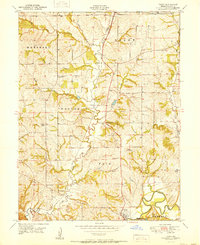
1951 Map of Tracy
USGS Topo · Published 1951About this map
Tracy and Platte City anchor the southeastern corner of this mid-century Missouri landscape, where the meandering loops of the Platte River create a sharp contrast with the structured grid of rural townships. The terrain is defined by a dense network of named drainage branches and creeks, such as Great Western Creek and Owl Creek, which carve through the hills of Weston and Fair. Two significant rail lines, the Chicago Great Western and the Chicago Bee Line, traverse the center, providing a glimpse into the transportation corridors that historically connected these agrarian communities.
Find a feature on this map
30 named features on this map. Tap any name to fly to it.
Don’t see what you’re looking for? This feature index may not catch every label — zoom into the map to look around manually.
Map Details
Editions of this 1951 Tracy Map
2 editions found
Other maps of this area

1890 · Kansas City
USGS Topo · 1:125,000

1894 · Kansas City
USGS Topo · 1:125,000

1910 · Leavenworth
USGS Topo · 1:62,500

1914 · Smithville
USGS Topo · 1:62,500

1925 · Gower
USGS Topo · 1:62,500

1927 · Dearborn
USGS Topo · 1:62,500

1948 · Leavenworth
USGS Topo · 1:62,500

1950 · Kansas City
USGS Topo · 1:250,000
1950 · Ferrelview
USGS Topo · 1:24,000
1950 · Platte City
USGS Topo · 1:24,000