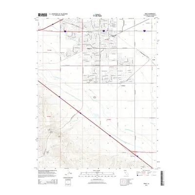
2015 Map of Tracy
USGS Topo · Published 2015About this map
Tracy serves as a critical junction for California water and transportation infrastructure, where the Governor Edmund G Brown California Aqueduct and Delta-Mendota Canal sweep across the landscape toward the San Joaquin Valley. To the north, the residential grids of Wainwright Village and the industrial corridors near Lyoth and Carbona reflect the area's growth as a logistics hub. This 2015 survey reveals the complex engineering required to move water through the region, including the subterranean Hetch Hetchy Aqueduct and numerous lateral canals like Lateral Four. The southern portion of the map transitions into the high ground of the Diablo Range, featuring landmarks such as Black Butte and the secluded Corral Hollow, providing a sharp contrast to the developed San Joaquin County plains. Genealogists may find interest in local landmarks like the Tracy Cemetery or the Brichetto Tomb located along the rural eastern roads.
Find a feature on this map
46 named features on this map. Tap any name to fly to it.
Don’t see what you’re looking for? This feature index may not catch every label — zoom into the map to look around manually.
Map Details
Editions of this 2015 Tracy Map
This is the sole edition of this map. No revisions or reprints were ever made.
Other maps of this area

1907 · Tesla
USGS Topo · 1:62,500

1913 · Romain
USGS Topo · 1:31,680

1914 · Bethany
USGS Topo · 1:31,680

1914 · Union Island
USGS Topo · 1:31,680

1915 · Vernalis
USGS Topo · 1:31,680

1915 · Lathrop
USGS Topo · 1:31,680

1916 · Byron
USGS Topo · 1:62,500

1916 · Tracy
USGS Topo · 1:31,680

1916 · Romain
USGS Topo · 1:31,680

1916 · Midway
USGS Topo · 1:31,680