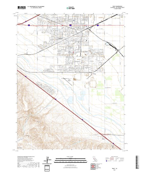
2021 Map of Tracy
USGS Topo · Published 2021About this map
Agricultural irrigation and transit corridors define the landscape around Tracy, where the massive water infrastructure of the Central Valley meets the rising elevations of the Diablo Range. The map documents the intricate network of the Governor Edmund G Brown California Aqueduct, the Delta-Mendota Canal, and the Hetch Hetchy Aqueduct as they traverse the valley floor. These engineering feats run parallel to the older rail-aligned settlements of Carbona and Lyoth, illustrating the evolution of California's water and transportation systems.
Find a feature on this map
30 named features on this map. Tap any name to fly to it.
Don’t see what you’re looking for? This feature index may not catch every label — zoom into the map to look around manually.
Map Details
Editions of this 2021 Tracy Map
This is the sole edition of this map. No revisions or reprints were ever made.
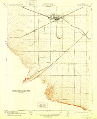
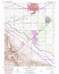
Historical Maps of Victoria Greens Through Time
3 maps found