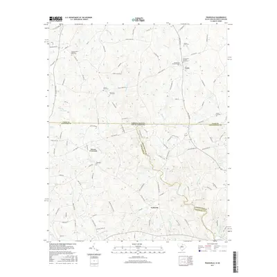
2017 Map of Tradesville
USGS Topo · Published 2017About this map
Stewart Crossroads serves as a central point in this rural landscape straddling the South Carolina and North Carolina border. The area is defined by the winding course of the Lynches River and its numerous tributaries, including Buffalo Cr and Polecat Cr. This 2017 survey reveals a deeply rooted community structure, anchored by several long-established religious sites and family burial grounds such as Prospect United Methodist Church Cem and the Walters Family Cem.
Find a feature on this map
108 named features on this map. Tap any name to fly to it.
Don’t see what you’re looking for? This feature index may not catch every label — zoom into the map to look around manually.
Map Details
Editions of this 2017 Tradesville Map
This is the sole edition of this map. No revisions or reprints were ever made.
Other maps of this area

1941 · Spartanburg
USGS Topo · 1:250,000

1953 · Spartanburg
USGS Topo · 1:250,000

1960 · Spartanburg
USGS Topo · 1:250,000

1963 · Spartanburg
USGS Topo · 1:250,000

1964 · Spartanburg
USGS Topo · 1:250,000

1968 · Jefferson
USGS Topo · 1:24,000

1969 · Antioch
USGS Topo · 1:24,000
1969 · Taxahaw
USGS Topo · 1:24,000
1970 · Wingate
USGS Topo · 1:24,000
1970 · Waxhaw
USGS Topo · 1:24,000