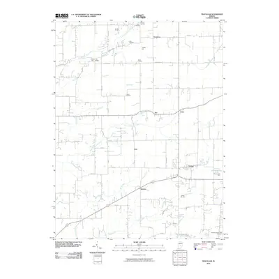
2010 Map of Trafalgar
USGS Topo · Published 2010About this map
Trafalgar and the surrounding farm country of Johnson County are defined by a network of creeks and small crossroads settlements in this 2010 survey. The landscape is a complex drainage basin for the North Prong Stotts Creek and South Prong Stotts Creek, which join several other waterways like Goose Creek and Barnes Creek to shape the local topography. Higher ground is marked by features such as Pea Ridge and Turkey Hill, providing a contrast to the lower creek beds that crisscross the agricultural grid.
Find a feature on this map
79 named features on this map. Tap any name to fly to it.
Don’t see what you’re looking for? This feature index may not catch every label — zoom into the map to look around manually.
Map Details
Editions of this 2010 Trafalgar Map
This is the sole edition of this map. No revisions or reprints were ever made.
Other maps of this area

1942 · Franklin
USGS Topo · 1:125,000

1947 · Franklin
USGS Topo · 1:62,500

1948 · Franklin
USGS Topo · 1:24,000

1948 · Trafalgar
USGS Topo · 1:24,000

1948 · Nineveh
USGS Topo · 1:24,000

1948 · Fruitdale
USGS Topo · 1:24,000

1948 · Morgantown
USGS Topo · 1:24,000

1950 · Morgantown
USGS Topo · 1:24,000

1950 · Franklin
USGS Topo · 1:62,500

1952 · Bargersville
USGS Topo · 1:24,000