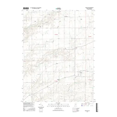
2016 Map of Trafalgar
USGS Topo · Published 2016About this map
Trafalgar serves as the primary hub for this portion of Johnson County, where the transition from agricultural plains to the dissected drainage of the White River watershed is visible. The landscape is defined by the dendritic branching of North Prong Stotts Creek and S Prong Stotts Cr, which carve through local high points such as Pea Ridge and Turkey Hill. These creek systems dictated the placement of early rural infrastructure, with small crossroads settlements like Samaria, Anita, and Bud emerging along the ridges and valley floors. Local history and genealogy interests are well-represented by several family and community burial grounds, including Shiloh Cem, Dollings Cem, and the Watts Cem near Providence. The presence of small aviation facilities like Bronson Airport and Kephart Field alongside established township boundaries like t12n r3e illustrates the continued use of this land for both traditional farming and modern light industry.
Find a feature on this map
69 named features on this map. Tap any name to fly to it.
Don’t see what you’re looking for? This feature index may not catch every label — zoom into the map to look around manually.
Map Details
Editions of this 2016 Trafalgar Map
This is the sole edition of this map. No revisions or reprints were ever made.
Other maps of this area

1942 · Franklin
USGS Topo · 1:125,000

1947 · Franklin
USGS Topo · 1:62,500

1948 · Franklin
USGS Topo · 1:24,000

1948 · Trafalgar
USGS Topo · 1:24,000

1948 · Nineveh
USGS Topo · 1:24,000

1948 · Fruitdale
USGS Topo · 1:24,000

1948 · Morgantown
USGS Topo · 1:24,000

1950 · Morgantown
USGS Topo · 1:24,000

1950 · Franklin
USGS Topo · 1:62,500

1952 · Bargersville
USGS Topo · 1:24,000