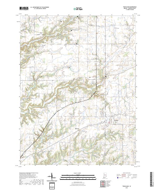
2022 Map of Trafalgar
USGS Topo · Published 2022About this map
Trafalgar serves as the central hub of this Johnson County landscape, where the local road network converges near the intersection of W Pearl St and S Allendale Dr. The surrounding area is defined by small agricultural settlements and hamlets such as Samaria, Bud, Anita, and Providence, which are linked by a grid of county roads crossing numerous waterways like Goose Cr and Indian Cr. For genealogists and local historians, the sheet is rich with family-named burial sites, including Shiloh Cem, Harris Cem, and Dollings Cem, often situated near prominent elevations like Pea Ridge or Turkey Hill. The inclusion of Bronson Airport and Kephart Field alongside the traditional farmstead patterns illustrates the modern evolution of this rural Indiana corridor between larger population centers.
Find a feature on this map
65 named features on this map. Tap any name to fly to it.
Don’t see what you’re looking for? This feature index may not catch every label — zoom into the map to look around manually.
Map Details
Editions of this 2022 Trafalgar Map
This is the sole edition of this map. No revisions or reprints were ever made.
Other maps of this area

1942 · Franklin
USGS Topo · 1:125,000

1947 · Franklin
USGS Topo · 1:62,500

1948 · Franklin
USGS Topo · 1:24,000

1948 · Trafalgar
USGS Topo · 1:24,000

1948 · Nineveh
USGS Topo · 1:24,000

1948 · Fruitdale
USGS Topo · 1:24,000

1948 · Morgantown
USGS Topo · 1:24,000

1950 · Morgantown
USGS Topo · 1:24,000

1950 · Franklin
USGS Topo · 1:62,500

1952 · Bargersville
USGS Topo · 1:24,000