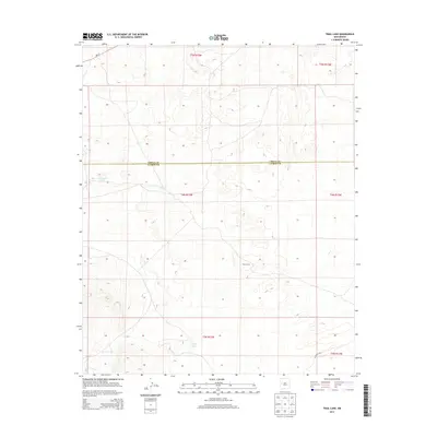
2013 Map of Trail Lake
USGS Topo · Published 2013About this map
The high plateau terrain of the New Mexico borderlands is defined here by the boundary between Cibola Co and Catron Co. This landscape, surveyed in the early 21st century by the U. S. Geological Survey, shows a sparsely populated region where water sources and livestock infrastructure dictate the human presence. Trail Lake and Canteen Lake serve as primary water features in an otherwise arid expanse, while Tusas Corral indicates the ongoing importance of ranching and land use patterns in this part of the Southwest. The map meticulously documents the township and range system, providing a clear view of the public land survey grid across this transition between two major New Mexico counties.
Find a feature on this map
4 named features on this map. Tap any name to fly to it.
Don’t see what you’re looking for? This feature index may not catch every label — zoom into the map to look around manually.
Map Details
Editions of this 2013 Trail Lake Map
This is the sole edition of this map. No revisions or reprints were ever made.
Other maps of this area

1954 · Saint Johns
USGS Topo · 1:250,000

1957 · Saint Johns
USGS Topo · 1:250,000

1958 · Saint Johns
USGS Topo · 1:250,000

1962 · Saint Johns
USGS Topo · 1:250,000
1967 · Tres Lagunas
USGS Topo · 1:24,000
1967 · York Ranch SE
USGS Topo · 1:24,000

1967 · Adams Diggings
USGS Topo · 1:24,000

1967 · Blue Hills
USGS Topo · 1:24,000
1967 · York Ranch
USGS Topo · 1:24,000

1967 · Veteado Mountain
USGS Topo · 1:24,000