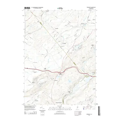
2014 Map of Tranquility
USGS Topo · Published 2014About this map
The Musconetcong River and Pequest River define the local topography of this New Jersey landscape, which spans the intersection of Sussex, Warren, and Morris counties. This survey documents the area's rural character and small-town structure, highlighting settlements like Tranquility, Greendell, and Huntsville. The map captures a mix of agricultural land and early 21st-century aviation infrastructure, including Trinca Airport and the Weiss Farm Airport. Regional landmarks such as the Ninety Five Mile Tree Lookout Tower and the historic Waterloo area along the Waterloo Lakes provide touchpoints for local historians. The presence of Villa Madonna and the neighboring Allamuchy Pond illustrates the area's diverse land use, ranging from private retreats to preserved water resources like Saxton Lake and Deer Park Pond.
Find a feature on this map
134 named features on this map. Tap any name to fly to it.
Don’t see what you’re looking for? This feature index may not catch every label — zoom into the map to look around manually.
Map Details
Editions of this 2014 Tranquility Map
This is the sole edition of this map. No revisions or reprints were ever made.
Other maps of this area

1888 · Franklin
USGS Topo · 1:62,500

1888 · Hackettstown
USGS Topo · 1:62,500

1888 · Lake Hopatcong
USGS Topo · 1:62,500

1891 · Wallpack
USGS Topo · 1:62,500

1893 · Wallpack
USGS Topo · 1:62,500

1894 · Hackettstown
USGS Topo · 1:62,500

1894 · Lake Hopatcong
USGS Topo · 1:62,500

1894 · Franklin
USGS Topo · 1:62,500

1897 · Franklin
USGS Topo · 1:62,500

1898 · Lake Hopatcong
USGS Topo · 1:62,500