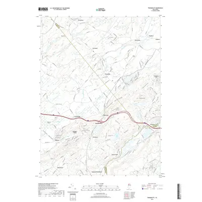
2019 Map of Tranquility
USGS Topo · Published 2019About this map
The Musconetcong River and the Pequest River valleys define this modern look at northwestern New Jersey. The terrain is dominated by Allamuchy Mtn, where hiking trails weave through the Deer Park Pond area. Local aviation is represented by small landing strips like Trinca Airport and Weiss Farm Airport, while the residential patterns show the growth of planned communities at Panther Valley. Several small settlements including Tranquility, Greendell, and Villa Madonna dot the landscape, separated by the boundaries of Sussex, Warren, and Morris Counties. To the south, the map centers on the northern reach of Hackettstown near Saxton Falls, where the river and local roads converge. This 2019 survey documents the region's contemporary suburban-rural balance, from the wooded slopes of the Allamuchy range to the active transport corridors connecting Allamuchy and Alphano.
Find a feature on this map
161 named features on this map. Tap any name to fly to it.
Don’t see what you’re looking for? This feature index may not catch every label — zoom into the map to look around manually.
Map Details
Editions of this 2019 Tranquility Map
This is the sole edition of this map. No revisions or reprints were ever made.
Other maps of this area

1888 · Franklin
USGS Topo · 1:62,500

1888 · Hackettstown
USGS Topo · 1:62,500

1888 · Lake Hopatcong
USGS Topo · 1:62,500

1891 · Wallpack
USGS Topo · 1:62,500

1893 · Wallpack
USGS Topo · 1:62,500

1894 · Hackettstown
USGS Topo · 1:62,500

1894 · Lake Hopatcong
USGS Topo · 1:62,500

1894 · Franklin
USGS Topo · 1:62,500

1897 · Franklin
USGS Topo · 1:62,500

1898 · Lake Hopatcong
USGS Topo · 1:62,500