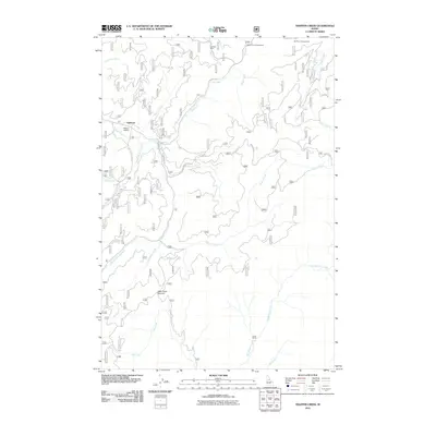
2011 Map of Trapper Creek
USGS Topo · Published 2011About this map
Red River and its numerous tributaries, including the South Fork Red River, Trapper Creek, and Big Mallard Creek, carve through this central Idaho landscape. The presence of the Steckner Mine near Steckner Creek points to the area's history of mineral exploration, while the Mullins Airstrip near Lightfoot illustrates the reliance on bush aviation for navigating this interior terrain.
Find a feature on this map
34 named features on this map. Tap any name to fly to it.
Don’t see what you’re looking for? This feature index may not catch every label — zoom into the map to look around manually.
Map Details
Editions of this 2011 Trapper Creek Map
This is the sole edition of this map. No revisions or reprints were ever made.
Other maps of this area

1956 · Elk City
USGS Topo · 1:250,000

1960 · Elk City
USGS Topo · 1:250,000

1966 · Elk City
USGS Topo · 1:24,000

1966 · Black Hawk Mtn
USGS Topo · 1:24,000

1966 · Sable Hill
USGS Topo · 1:24,000

1977 · Boston Mtn
USGS Topo · 1:24,000

1978 · Moose Butte
USGS Topo · 1:24,000

1978 · Hida Point
USGS Topo · 1:24,000

1978 · Trapper Creek
USGS Topo · 1:24,000

1979 · Dixie
USGS Topo · 1:24,000