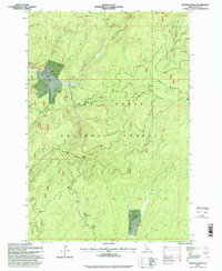
1995 Map of Trapper Creek
USGS Topo · Published 1999About this map
Red River and its various tributaries carve through the Nez Perce National Forest in this mid-1990s survey. The landscape is defined by its industrial and administrative footprint, notably the Red River Ranger Station and an airstrip situated near the intersection of Little Moose Creek and the main river. Historical mining activity is evident along the northern waterways, where dredge tailings line the banks and sites like the Streckner Mine and various prospects are documented.
Find a feature on this map
37 named features on this map. Tap any name to fly to it.
Don’t see what you’re looking for? This feature index may not catch every label — zoom into the map to look around manually.
Map Details
Editions of this 1995 Trapper Creek Map
This is the sole edition of this map. No revisions or reprints were ever made.
Other maps of this area

1956 · Elk City
USGS Topo · 1:250,000

1960 · Elk City
USGS Topo · 1:250,000

1966 · Elk City
USGS Topo · 1:24,000

1966 · Black Hawk Mtn
USGS Topo · 1:24,000

1966 · Sable Hill
USGS Topo · 1:24,000

1977 · Boston Mtn
USGS Topo · 1:24,000

1978 · Moose Butte
USGS Topo · 1:24,000

1978 · Hida Point
USGS Topo · 1:24,000

1978 · Trapper Creek
USGS Topo · 1:24,000

1979 · Dixie
USGS Topo · 1:24,000