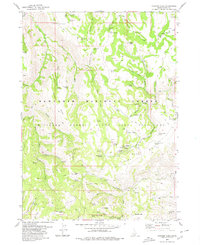
1979 Map of Trapper Peak
USGS Topo · Published 1979About this map
Sawtooth National Forest dominates this Idaho landscape, characterized by high-altitude peaks and a dense network of mountain springs. The high country is punctuated by landmarks such as Trapper Peak, Harrington Peak, and Badger Mtn, with the northern reaches featuring a concentration of water sources like Coal Pit Spring and Briggs Spring. The presence of the Minidoka State Bird Sanctuary and the Bostetter Forest Service Station highlights the era's focus on conservation and forest management within Cassia County.
Find a feature on this map
76 named features on this map. Tap any name to fly to it.
Don’t see what you’re looking for? This feature index may not catch every label — zoom into the map to look around manually.
Map Details
Editions of this 1979 Trapper Peak Map
This is the sole edition of this map. No revisions or reprints were ever made.
Other maps of this area

1955 · Twin Falls
USGS Topo · 1:250,000

1958 · Twin Falls
USGS Topo · 1:250,000

1965 · Rams Horn Ridge
USGS Topo · 1:24,000

1965 · Grand View Peak
USGS Topo · 1:24,000

1965 · Buckhorn Canyon
USGS Topo · 1:24,000

1977 · Timber Butte
USGS Topo · 1:24,000

1977 · Mahogany Butte
USGS Topo · 1:24,000
1977 · Ibex Peak
USGS Topo · 1:24,000
1978 · Pike Mountain
USGS Topo · 1:24,000
1978 · Severe Spring
USGS Topo · 1:24,000