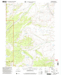
2000 Map of Trapper
USGS Topo · Published 2004About this map
The Routt National Forest and White River National Forest converge on this high-altitude landscape, where managed water resources define the local terrain. The Finger Rock Fish Hatchery is a prominent landmark in the northeast, positioned near the settlement of Trapper. This area is characterized by significant water engineering, including the Roaring Fork Ditch and Meore Ditch, which redirect snowmelt and runoff across the complex topography of Porcupine Ridge and Five Pine Mesa.
Find a feature on this map
36 named features on this map. Tap any name to fly to it.
Don’t see what you’re looking for? This feature index may not catch every label — zoom into the map to look around manually.
Map Details
Editions of this 2000 Trapper Map
This is the sole edition of this map. No revisions or reprints were ever made.
Other maps of this area

1927 · Glenwood Springs
USGS Topo · 1:125,000

1930 · Glenwood Springs
USGS Topo · 1:125,000

1954 · Craig
USGS Topo · 1:250,000

1957 · Craig
USGS Topo · 1:250,000

1957 · Leadville
USGS Topo · 1:250,000

1958 · Craig
USGS Topo · 1:250,000

1959 · Leadville
USGS Topo · 1:250,000

1960 · Leadville
USGS Topo · 1:250,000

1960 · Craig
USGS Topo · 1:250,000

1962 · Leadville
USGS Topo · 1:250,000