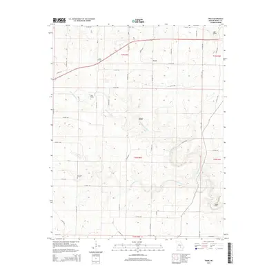
2015 Map of Trask
USGS Topo · Published 2015About this map
Sims Valley and the small community of Trask center this Ozark landscape as it appeared in 2015. The region is defined by its deep drainages and ridges, notably the Eleven Point River which meanders through the central and eastern portions of the map. For genealogists and local historians, several landmark sites are preserved, including the Rowe Cemetery near the northern boundary and the Lost Camp Cemetery located further south near Lost Camp Cr. The terrain is characterized by named topographic features such as Robbins Hollow, Barn Hollow, and Brooks Ridge, which illustrate the traditional nomenclature of the Missouri interior. A dense network of county roads, such as CO Road 2150 and CO Road 2870, provides a clear view of the modern rural settlement patterns and access points to the river valley.
Find a feature on this map
53 named features on this map. Tap any name to fly to it.
Don’t see what you’re looking for? This feature index may not catch every label — zoom into the map to look around manually.
Map Details
Editions of this 2015 Trask Map
This is the sole edition of this map. No revisions or reprints were ever made.
Other maps of this area

1945 · Willow Springs
USGS Topo · 1:62,500

1945 · Montier
USGS Topo · 1:62,500

1945 · Clear Springs
USGS Topo · 1:62,500

1946 · Summersville
USGS Topo · 1:62,500

1948 · Clear Springs
USGS Topo · 1:62,500

1948 · Montier
USGS Topo · 1:62,500

1948 · Willow Springs
USGS Topo · 1:62,500

1948 · Summersville
USGS Topo · 1:62,500

1949 · Rolla
USGS Topo · 1:250,000

1953 · Rolla
USGS Topo · 1:250,000