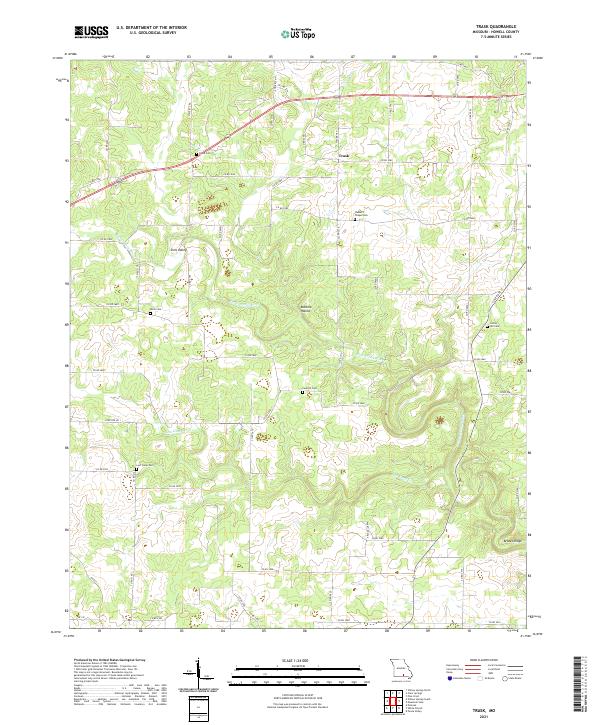
2021 Map of Trask
USGS Topo · Published 2021About this map
Trask and the surrounding Ozark landscape in Howell County are defined by the winding course of the Eleven Point River, which carves through the local topography. This 2021 survey shows a rural environment where land use is dictated by the rugged drainages of Robbins Hollow and the elevated terrain of Brooks Ridge. Genealogists will find a high density of small family and community burial sites scattered across the township, including Rowe Cem in the north and Lost Camp Cem further south.
Find a feature on this map
58 named features on this map. Tap any name to fly to it.
Don’t see what you’re looking for? This feature index may not catch every label — zoom into the map to look around manually.
Map Details
Editions of this 2021 Trask Map
This is the sole edition of this map. No revisions or reprints were ever made.
Other maps of this area

1945 · Willow Springs
USGS Topo · 1:62,500

1945 · Montier
USGS Topo · 1:62,500

1945 · Clear Springs
USGS Topo · 1:62,500

1946 · Summersville
USGS Topo · 1:62,500

1948 · Clear Springs
USGS Topo · 1:62,500

1948 · Montier
USGS Topo · 1:62,500

1948 · Willow Springs
USGS Topo · 1:62,500

1948 · Summersville
USGS Topo · 1:62,500

1949 · Rolla
USGS Topo · 1:250,000

1953 · Rolla
USGS Topo · 1:250,000