Loading...
Loading map...2021 Map of Traver
USGS Topo · Published 2021About this map
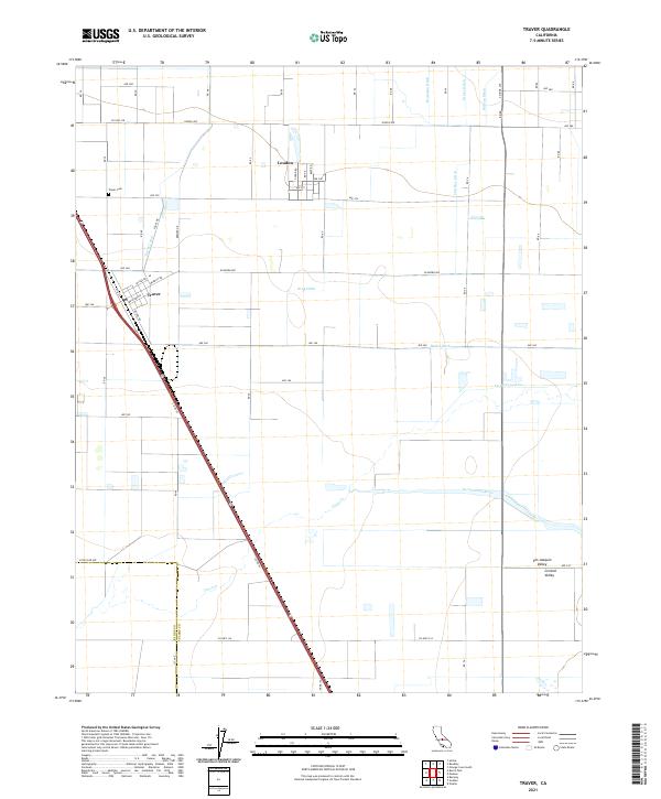
The agricultural landscape of the Central Valley is meticulously detailed here, centered on the historic settlements of Traver and London. Situated within the San Joaquin Valley, this area is defined by a dense network of irrigation infrastructure essential to the region's productivity. Major watercourses such as the Saint Johns River and Cross Cr are supplemented by an intricate system of man-made channels including the Traver Canal, King Ditch, and Banks Ditch.
Find a feature on this map
42 named features on this map. Tap any name to fly to it.
Don’t see what you’re looking for? This feature index may not catch every label — zoom into the map to look around manually.
Map Details
Date Portrayed2021
Date Published2021
PublisherU.S. Geological Survey
Map TypeTopographic
Scale1:24000
Physical Dimensions24 x 29 inches
Editions of this 2021 Traver Map
This is the sole edition of this map. No revisions or reprints were ever made.
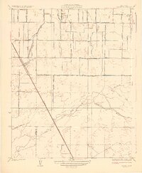
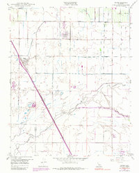
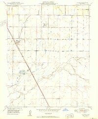
Historical Maps of Traver Through Time
4 maps found
Featured Locations
Source Details
SourceU.S. Geological Survey
CopyrightPublic Domain