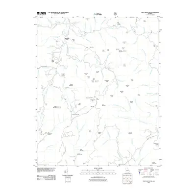
2011 Map of Tray Mountain
USGS Topo · Published 2011About this map
Mountain Scene serves as a primary point of reference in this landscape of the Blue Ridge, where high elevations and complex drainage systems define the geography. The terrain is marked by prominent peaks such as Tray Mountain, Dismal Mountain, and Chimney Mountain, with numerous gaps including Unicoi Gap and Addis Gap providing natural passage through the ridges. The area is heavily shaped by water, with the North Prong Left Fork Soquee River and South Fork Moccasin Creek among the many headwaters shown. Recreation and conservation are central to this territory, evidenced by the Anna Ruby Falls Scenic Area and High Shoals Falls Scenic Area. These protected zones, alongside the Andrews Cove Campground and Anna Ruby Campground, suggest a landscape valued for its natural landmarks and water features. Local history is etched into the topography through family-named features like Woods Branch and Wike Gap, alongside descriptive locales such as Mill Creek Roughs and Hickory Flat Cove.
Find a feature on this map
123 named features on this map. Tap any name to fly to it.
Don’t see what you’re looking for? This feature index may not catch every label — zoom into the map to look around manually.
Map Details
Editions of this 2011 Tray Mountain Map
This is the sole edition of this map. No revisions or reprints were ever made.
Other maps of this area

1886 · Dahlonega
USGS Topo · 1:125,000

1892 · Dahlonega
USGS Topo · 1:125,000

1896 · Dahlonega
USGS Topo · 1:125,000

1903 · Dahlonega
USGS Topo · 1:125,000

1935 · Osborn
USGS Topo · 1:24,000

1935 · Cowrock
USGS Topo · 1:24,000

1935 · Hightower Bald
USGS Topo · 1:24,000

1935 · Tray Mountain
USGS Topo · 1:24,000

1935 · Jacks Gap
USGS Topo · 1:24,000
1935 · Hiawassee
USGS Topo · 1:24,000