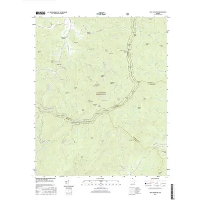
2017 Map of Tray Mountain
USGS Topo · Published 2017About this map
Mountain Scene and the rural enclave of Hickory Flat Cove anchor this high-elevation portion of the Chattahoochee National Forest where the borders of Towns, Habersham, Rabun, and White counties converge. The landscape is defined by the winding path of the Appalachian National Scenic Trail, which traverses prominent heights such as Tray Mountain and Big Stamp. This survey captures the complex drainage network of the Hiawassee River and S Fork Moccasin Cr, alongside historic routes like the Unicoi Tpke. The proximity of landmarks like Anna Ruby Falls and named hollows such as Grapevine Cove reflects a geography deeply shaped by both its protected status and the old mountain roads, including Tray Mountain Rd and Indian Grave Gap Rd, that provided early access to these ridges.
Find a feature on this map
136 named features on this map. Tap any name to fly to it.
Don’t see what you’re looking for? This feature index may not catch every label — zoom into the map to look around manually.
Map Details
Editions of this 2017 Tray Mountain Map
This is the sole edition of this map. No revisions or reprints were ever made.
Other maps of this area

1886 · Dahlonega
USGS Topo · 1:125,000

1892 · Dahlonega
USGS Topo · 1:125,000

1896 · Dahlonega
USGS Topo · 1:125,000

1903 · Dahlonega
USGS Topo · 1:125,000

1935 · Osborn
USGS Topo · 1:24,000

1935 · Cowrock
USGS Topo · 1:24,000

1935 · Hightower Bald
USGS Topo · 1:24,000

1935 · Tray Mountain
USGS Topo · 1:24,000

1935 · Jacks Gap
USGS Topo · 1:24,000
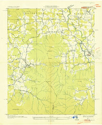
1935 · Hiawassee
USGS Topo · 1:24,000