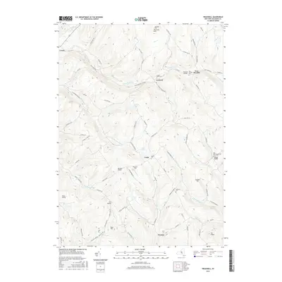
2016 Map of Treadwell
USGS Topo · Published 2016About this map
Treadwell and its neighboring rural hamlets are the focus of this 2016 topographical study of Delaware County, New York. The landscape is defined by the high ridges separating numerous narrow valleys, where small settlements like Arabia and Leonta are linked by winding roads such as Delhi-Leonta Rd and Cty Hwy 14. The drainage pattern is particularly evident, with Treadwell Creek and the W Br Handsome Brook carving through the terrain. Genealogists will find a wealth of local markers, including the West Delhi Presbyterian Church and several family-named resting places like the Goldsmith Cem and Arabia Cem. The presence of Blueberry Field and Fish Hollow further illustrates the agricultural and geographical character of the region. This map serves as an excellent resource for understanding the modern distribution of homesteads and naming conventions that have persisted in these upland valleys for generations.
Find a feature on this map
79 named features on this map. Tap any name to fly to it.
Don’t see what you’re looking for? This feature index may not catch every label — zoom into the map to look around manually.
Map Details
Editions of this 2016 Treadwell Map
This is the sole edition of this map. No revisions or reprints were ever made.
Other maps of this area

1909 · Delhi
USGS Topo · 1:62,500

1911 · Delhi
USGS Topo · 1:62,500

1915 · Oneonta
USGS Topo · 1:62,500

1918 · Oneonta
USGS Topo · 1:62,500

1922 · Andes
USGS Topo · 1:62,500

1923 · Walton
USGS Topo · 1:48,000

1924 · Andes
USGS Topo · 1:62,500

1925 · Walton
USGS Topo · 1:62,500

1943 · Delhi
USGS Topo · 1:24,000

1943 · Franklin
USGS Topo · 1:24,000