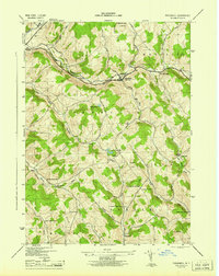
1945 Map of Treadwell
USGS Topo · Published 1945About this map
The settlement of Treadwell and its neighboring rural communities are documented in this 1943 survey, revealing a landscape defined by steep hills and an intricate network of one-room schoolhouses. Notable for its educational density, the map identifies several distinct rural schools including Sch No 11, the Bennett Hollow Sch, and the uniquely named Blue School. These institutions, alongside the Stoodley Hollow School and North Hamden School, served the scattered farming families inhabiting the hollows.
Find a feature on this map
43 named features on this map. Tap any name to fly to it.
Don’t see what you’re looking for? This feature index may not catch every label — zoom into the map to look around manually.
Map Details
Editions of this 1945 Treadwell Map
This is the sole edition of this map. No revisions or reprints were ever made.
Other maps of this area

1909 · Delhi
USGS Topo · 1:62,500

1911 · Delhi
USGS Topo · 1:62,500

1915 · Oneonta
USGS Topo · 1:62,500

1918 · Oneonta
USGS Topo · 1:62,500

1922 · Andes
USGS Topo · 1:62,500

1923 · Walton
USGS Topo · 1:48,000

1924 · Andes
USGS Topo · 1:62,500

1925 · Walton
USGS Topo · 1:62,500

1943 · Delhi
USGS Topo · 1:24,000

1943 · Franklin
USGS Topo · 1:24,000