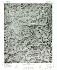
1974 Map of Treat NE
USGS Topo · Published 1975About this map
Pelsor serves as the primary upland settlement in this 1974 orthophotoquad, situated where clearings break through the dense timber of the Arkansas highlands. The aerial photography reveals the stark character of the terrain, defined by the deep incisions of the Richland and Illinois watercourses. Unlike traditional topographic maps, this imagery-based survey provides a direct view of the mid-1970s land use, showing the exact footprint of small farmsteads and the sinuous paths of mountain roads as they navigate the ridges and valleys near the Fork of these drainage systems. The contrast between the wooded slopes and the small, scattered open fields near the settlement offers a precise record of rural life and land management during this era.
Find a feature on this map
4 named features on this map. Tap any name to fly to it.
Don’t see what you’re looking for? This feature index may not catch every label — zoom into the map to look around manually.
Map Details
Editions of this 1974 Treat NE Map
This is the sole edition of this map. No revisions or reprints were ever made.
Other maps of this area

1879 · Washington
USGS Topo · 1:62,500

1887 · Smyrna
USGS Topo · 1:62,500

1889 · Treat
USGS Topo · 1:62,500

1889 · Marshall #3
USGS Topo · 1:62,500

1892 · Marshall
USGS Topo · 1:125,000

1894 · Marshall
USGS Topo · 1:125,000

1901 · Marshall
USGS Topo · 1:125,000

1932 · Treat
USGS Topo · 1:62,500

1933 · Mt Judea
USGS Topo · 1:62,500

1934 · Treat
USGS Topo · 1:62,500