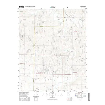
2014 Map of Treat
USGS Topo · Published 2014About this map
Big Piney Creek winds through the heart of the Ozark National Forest, carving a landscape of high ridges and deep hollows along the Johnson and Pope county line. The small settlement of Treat sits near the northern boundary, while Bullfrog Valley and Silex occupy the southern reaches, where the terrain begins to yield to the Silex Gas Field. This 2014 survey documents a region defined by its narrow passages and family-named landmarks, from the sharp turn at The Narrows to the broad Wainscott Bottom. Rural life is centered around scattered gathering points like Grimmet Springs and several local burial grounds, including Treat Cem and Shannon Cem. Transport through this elevation-heavy country relies on primitive routes such as Newton Knob Rd and Jakes Creek Rd, tracing the natural gaps between peaks like Pilot Rock Mtn and Waldo Mtn.
Find a feature on this map
71 named features on this map. Tap any name to fly to it.
Don’t see what you’re looking for? This feature index may not catch every label — zoom into the map to look around manually.
Map Details
Editions of this 2014 Treat Map
This is the sole edition of this map. No revisions or reprints were ever made.
Other maps of this area

1888 · Dardanelle #2
USGS Topo · 1:62,500

1888 · Dardanelle #1
USGS Topo · 1:62,500

1889 · Treat
USGS Topo · 1:62,500

1889 · Ozone
USGS Topo · 1:62,500

1890 · Dardanelle
USGS Topo · 1:125,000

1932 · Treat
USGS Topo · 1:62,500

1934 · Treat
USGS Topo · 1:62,500

1934 · Ozone
USGS Topo · 1:62,500

1936 · Ozone
USGS Topo · 1:62,500

1956 · Russellville
USGS Topo · 1:250,000