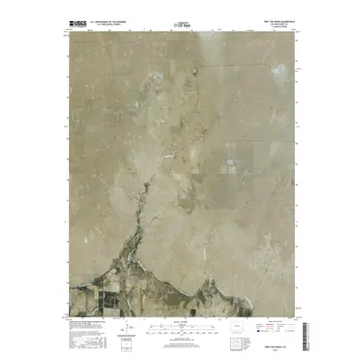
2016 Map of Tree Top Ranch
USGS Topo · Published 2016About this map
Tree Top Ranch serves as a central landmark in this high plains landscape of Bent County, where the agricultural economy depends on a complex network of water management features. The southern portion of the quadrangle is defined by the significant engineering of the Fort Lyon Canal and the Kicking Bird Canal, which diverted water from the Arkansas River to support local ranching and farming operations. These man-made waterways contrast with the natural drainage patterns of Gageby Cr and McRae Arroyo, illustrating the mid-20th-century transition toward intensive irrigation. In the northeast, Long Lake provides a rare perennial water source in an otherwise arid expanse. The map details the rural infrastructure of the era, from the winding paths of Miller Ditch to the straight-line reliability of Fort Lyon Canal Rd and Co RD 17.
Find a feature on this map
17 named features on this map. Tap any name to fly to it.
Don’t see what you’re looking for? This feature index may not catch every label — zoom into the map to look around manually.
Map Details
Editions of this 2016 Tree Top Ranch Map
This is the sole edition of this map. No revisions or reprints were ever made.
Other maps of this area

1891 · Las Animas
USGS Topo · 1:125,000

1892 · Lamar
USGS Topo · 1:125,000

1893 · Las Animas
USGS Topo · 1:125,000

1953 · Hasty
USGS Topo · 1:24,000

1953 · Las Animas
USGS Topo · 1:24,000

1953 · Kreybill
USGS Topo · 1:24,000

1954 · Lamar
USGS Topo · 1:250,000

1955 · Tree Top Ranch
USGS Topo · 1:24,000

1955 · Lubers
USGS Topo · 1:24,000

1955 · Bishop Ranch
USGS Topo · 1:24,000