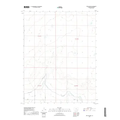
2019 Map of Tree Top Ranch
USGS Topo · Published 2019About this map
Tree Top Ranch anchors the southern portion of this landscape in Bent County, where the plains are defined by an intricate network of irrigation systems and drainage channels. The agricultural history of the region is evident in the managed flow of the Fort Lyon Canal and the Kicking Bird Canal, which navigate the contours of the terrain alongside the Miller Ditch. These man-made waterways contrast with the natural drainage of Gageby Cr and McRae Arroyo, illustrating how water management shaped the settlement patterns of Colorado's eastern plains. The map reveals a transition from the higher plateaus in the north, punctuated by Long Lake, down to the valley floor. Rural travel is facilitated by a grid of county roads, including Co RD 17 and Fort Lyon Canal Rd, which provide access to the dispersed ranching operations and public land survey sections characteristic of this high-desert environment.
Find a feature on this map
17 named features on this map. Tap any name to fly to it.
Don’t see what you’re looking for? This feature index may not catch every label — zoom into the map to look around manually.
Map Details
Editions of this 2019 Tree Top Ranch Map
This is the sole edition of this map. No revisions or reprints were ever made.
Other maps of this area

1891 · Las Animas
USGS Topo · 1:125,000

1892 · Lamar
USGS Topo · 1:125,000

1893 · Las Animas
USGS Topo · 1:125,000

1953 · Hasty
USGS Topo · 1:24,000

1953 · Las Animas
USGS Topo · 1:24,000

1953 · Kreybill
USGS Topo · 1:24,000

1954 · Lamar
USGS Topo · 1:250,000

1955 · Tree Top Ranch
USGS Topo · 1:24,000

1955 · Lubers
USGS Topo · 1:24,000

1955 · Bishop Ranch
USGS Topo · 1:24,000