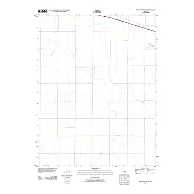
2009 Map of Trego Center NE
USGS Topo · Published 2009About this map
Big Creek meanders across this rural section of Trego County, defining much of the local hydrology within a landscape marked by systematic agricultural partitioning. The presence of the Ogallah Oil Field in the northeastern corner indicates the intersection of the region's ranching and farming identity with its energy extraction history. Transportation corridors are dominated by the parallel routes of Interstate 70 and U.S. Route 40, which cut across the northern portion of the quadrangle. These highways represent the modern evolution of travel through the Great Plains, mirroring the older sectional road grid that facilitates movement between isolated farmsteads and the larger trade centers located just beyond the map's borders.
Find a feature on this map
4 named features on this map. Tap any name to fly to it.
Don’t see what you’re looking for? This feature index may not catch every label — zoom into the map to look around manually.
Map Details
Editions of this 2009 Trego Center NE Map
This is the sole edition of this map. No revisions or reprints were ever made.
Other maps of this area

1893 · Ellis
USGS Topo · 1:125,000

1893 · Hill
USGS Topo · 1:125,000

1955 · Great Bend
USGS Topo · 1:250,000

1955 · Beloit
USGS Topo · 1:250,000

1957 · Great Bend
USGS Topo · 1:250,000

1958 · Great Bend
USGS Topo · 1:250,000

1959 · Beloit
USGS Topo · 1:250,000
1960 · Trego Center
USGS Topo · 1:24,000
1960 · Trego Center NE
USGS Topo · 1:24,000
1961 · Ogallah
USGS Topo · 1:24,000