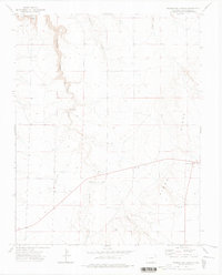
1972 Map of Trementina Canyon
USGS Topo · Published 1976About this map
The Purgatoire River cuts through the northwest corner of this Colorado landscape, defining a terrain of deep drainages and named ridges in Las Animas County. During the early 1970s, this area was characterized by a rural, ranching-oriented infrastructure, most notably centered around Walts Corner and its adjacent Picnic Area in the southeast. The map reveals the practical necessities of this remote country, including an isolated Landing Strip and several wells scattered across the high plains. Extensive canyon systems like Trementina Canyon, Gutiérrez Canyon, and Trujillo Canyon channel seasonal water toward the river, while landmarks like Pinon and Ridge provide orientation across the elevation changes. For local historians, the presence of various gravel pits suggests the small-scale industrial activity required for road maintenance in this sparsely populated region.
Find a feature on this map
16 named features on this map. Tap any name to fly to it.
Don’t see what you’re looking for? This feature index may not catch every label — zoom into the map to look around manually.
Map Details
Editions of this 1972 Trementina Canyon Map
This is the sole edition of this map. No revisions or reprints were ever made.
Other maps of this area

1891 · Mesa De Maya
USGS Topo · 1:125,000

1892 · Elmoro
USGS Topo · 1:125,000

1893 · Elmoro
USGS Topo · 1:125,000

1893 · Mesa de Maya
USGS Topo · 1:125,000

1897 · Elmoro
USGS Topo · 1:125,000

1954 · Trinidad
USGS Topo · 1:250,000

1955 · La Junta
USGS Topo · 1:250,000

1955 · Trinidad
USGS Topo · 1:250,000

1958 · La Junta
USGS Topo · 1:250,000

1958 · Trinidad
USGS Topo · 1:250,000