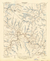
1904 Map of Trent River
USGS Topo · Published 1946About this map
The Trent River carves a winding path through the lowlands of Jones and Craven Counties, defining a landscape dominated by extensive wetlands like the Great Dover Swamp and Whiteoak Pocoson. At the turn of the century, the river served as a vital commercial artery, evidenced by a dense concentration of riverfront infrastructure including Steamboat Horse Landing, White Bank Landing, and Log Landing. These points of transit supported local agriculture and the timber industry, connecting remote farmsteads to larger markets via the water.
Find a feature on this map
72 named features on this map. Tap any name to fly to it.
Don’t see what you’re looking for? This feature index may not catch every label — zoom into the map to look around manually.
Map Details
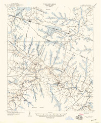
Editions of this 1904 Trent River Map
3 editions found
Other maps of this area

1901 · New Bern
USGS Topo · 1:62,500

1902 · Ayden
USGS Topo · 1:62,500

1902 · Vanceboro
USGS Topo · 1:62,500

1903 · New Bern
USGS Topo · 1:62,500

1903 · Trent River
USGS Topo · 1:62,500

1904 · Ayden
USGS Topo · 1:62,500

1904 · Trent River
USGS Topo · 1:62,500

1904 · Vanceboro
USGS Topo · 1:62,500

1905 · Vanceboro
USGS Topo · 1:62,500

1914 · Kinston
USGS Topo · 1:48,000