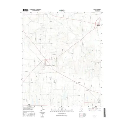
2016 Map of Trenton
USGS Topo · Published 2016About this map
Trenton and Leonard anchor this portion of southern Fannin County, where the north Texas landscape is defined by a dense network of county roads and meandering creek systems. The drainage patterns of Bois d'Arc Cr and Cottonwood Cr dominate the eastern half of the sheet, while western reaches are shaped by Bailey Cr and Chinquapin Cr. Several small rural communities and historic points of interest are documented, including Orangeville and Nobility. This survey captures the layout of the region's agricultural and transportation infrastructure, showing the relationship between local hubs and peripheral landmarks like Red Wing Airport. Genealogists will find value in the placement of several local burial grounds, such as Randolph Cem, Burns Cem, and Bailey Cem, which are situated along the winding backroads between the larger settlements.
Find a feature on this map
95 named features on this map. Tap any name to fly to it.
Don’t see what you’re looking for? This feature index may not catch every label — zoom into the map to look around manually.
Map Details
Editions of this 2016 Trenton Map
This is the sole edition of this map. No revisions or reprints were ever made.
Other maps of this area

1954 · Sherman
USGS Topo · 1:250,000

1958 · Bonham
USGS Topo · 1:62,500

1958 · Whitesright
USGS Topo · 1:62,500

1958 · Sherman
USGS Topo · 1:250,000

1960 · Blue Ridge
USGS Topo · 1:24,000

1960 · Pike
USGS Topo · 1:24,000

1964 · Trenton
USGS Topo · 1:24,000
1964 · Pilot Grove
USGS Topo · 1:24,000

1964 · Celeste
USGS Topo · 1:24,000
1964 · Leonard
USGS Topo · 1:24,000