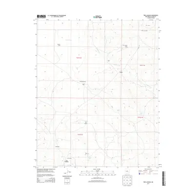
2013 Map of Tres Lagunas
USGS Topo · Published 2013About this map
Tres Lagunas and the surrounding high-desert terrain of Catron County appear in this 2013 survey, defined by a network of drainage features and stock tanks essential to this arid environment. The landscape is characterized by prominent geographic markers like Freeland Arroyo, which winds through the northern sections near the small settlement of Lehew. This area reflects a reliance on livestock and private aviation, evidenced by ranching infrastructure and local airfields such as Poco Loco Airport and Dream Catcher Ranch Airport.
Find a feature on this map
25 named features on this map. Tap any name to fly to it.
Don’t see what you’re looking for? This feature index may not catch every label — zoom into the map to look around manually.
Map Details
Editions of this 2013 Tres Lagunas Map
This is the sole edition of this map. No revisions or reprints were ever made.
Other maps of this area

1917 · Broom Mountain
USGS Topo · 1:125,000

1954 · Saint Johns
USGS Topo · 1:250,000

1954 · Socorro
USGS Topo · 1:250,000

1957 · Saint Johns
USGS Topo · 1:250,000

1958 · Socorro
USGS Topo · 1:250,000

1958 · Saint Johns
USGS Topo · 1:250,000

1962 · Socorro
USGS Topo · 1:250,000

1962 · Saint Johns
USGS Topo · 1:250,000

1964 · Third Canyon
USGS Topo · 1:24,000
1964 · Bonine Canyon
USGS Topo · 1:24,000